Types Of Fronts
Types of fronts are one of the most important concepts in meteorology. They are the boundaries between different air masses, and they play a crucial role in shaping the weather we experience every day. Fronts can be classified into four main types: cold fronts, warm fronts, stationary fronts, and occluded fronts. Each type has its own unique characteristics and can cause different weather events.
Cold fronts occur when a cold air mass advances and replaces a warmer air mass. The boundary between the two air masses is called a cold front. As the cold air moves forward, it lifts the warm air, causing it to cool and condense into clouds. This can lead to the formation of thunderstorms, heavy rain, and even tornadoes. In contrast, warm fronts occur when a warm air mass advances and replaces a colder air mass. The boundary between the two air masses is called a warm front. As the warm air advances, it rises over the cold air, causing it to cool and condense into clouds. This can lead to the formation of light rain or drizzle.
Stationary fronts occur when two air masses meet, but neither is strong enough to replace the other. The boundary between the two air masses remains stationary, and weather conditions can persist for several days. Occluded fronts occur when a fast-moving cold front catches up to a slow-moving warm front. The warm air is lifted and replaced by cooler air, creating an occluded front. This can lead to the formation of rain or snow.
Key Takeaways
- There are four main types of weather fronts: cold fronts, warm fronts, stationary fronts, and occluded fronts.
- Each type of front has its own unique characteristics and can cause different weather events.
- Understanding the different types of fronts and their associated weather patterns is crucial for predicting and tracking weather systems.
Classification of Weather Fronts

Weather fronts are the boundaries between two air masses with different temperatures, humidity levels, and pressure. There are four main types of weather fronts: cold fronts, warm fronts, stationary fronts, and occluded fronts. Each type of front is associated with different weather conditions.
Cold Fronts
Cold fronts occur when a cold air mass moves in and replaces a warmer air mass. The cold air mass is denser and tends to push the warm air mass up and out of the way. As the warm air rises, it cools and condenses, forming clouds and potentially causing precipitation. Cold fronts often bring gusty winds and rapid temperature drops.
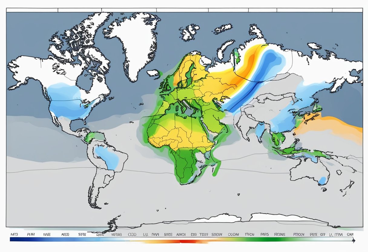
On weather maps, cold fronts are indicated by a solid blue line with triangles pointing in the direction of movement.
Warm Fronts
Warm fronts occur when a warm air mass moves in and replaces a cold air mass. The warm air mass is less dense and tends to rise over the cold air mass. As the warm air rises, it cools and condenses, forming clouds and potentially causing precipitation. Warm fronts often bring milder temperatures and steady precipitation.
On weather maps, warm fronts are indicated by a solid red line with semicircles pointing in the direction of movement.
Stationary Fronts
Stationary fronts occur when two air masses meet but neither is strong enough to replace the other. The boundary between the two air masses remains stationary, and weather patterns can persist for days or even weeks. Stationary fronts often bring cloudy skies and precipitation.
On weather maps, stationary fronts are indicated by a line with alternating blue triangles and red semicircles pointing in opposite directions.
Occluded Fronts
Occluded fronts occur when a cold front catches up to a warm front and lifts the warm air mass off the ground. As the warm air rises, it cools and condenses, forming clouds and precipitation. Occluded fronts often bring strong winds and heavy precipitation.
On weather maps, occluded fronts are indicated by a line with alternating purple triangles and semicircles pointing in the direction of movement.
In summary, understanding the different types of weather fronts is important for predicting weather patterns and preparing for potential weather hazards. Weather maps are an important tool for identifying and tracking these fronts.
Characteristics of Frontal Systems
Frontal systems are the boundaries between two air masses with different properties. They are responsible for most of the weather changes that occur on the planet. Frontal systems can be classified into four types: cold fronts, warm fronts, stationary fronts, and occluded fronts. Each type has its own unique characteristics, which are discussed below.
Temperature Changes
Temperature changes are one of the most noticeable characteristics of frontal systems. When a cold air mass meets a warm air mass, the colder air replaces the warmer air, resulting in a temperature drop. This temperature change can be sudden and drastic, leading to thunderstorms, hail, and tornadoes. On the other hand, when a warm air mass meets a cold air mass, the warmer air replaces the colder air, resulting in a temperature rise. This temperature change is usually gradual and less severe than that of a cold front.
Wind Patterns
Another characteristic of frontal systems is their effect on wind patterns. The wind direction changes as the front passes through an area. Before the front arrives, the wind blows from the direction of the warmer air mass. After the front passes, the wind direction changes to the direction of the colder air mass. The wind speed also increases as the front approaches and decreases as it passes.
Pressure Variations
Frontal systems also affect atmospheric pressure. Before the front arrives, the pressure drops as warm air rises and cold air sinks. After the front passes, the pressure rises as cold air replaces warm air. The pressure change is usually more significant in a cold front than in a warm front.
In summary, frontal systems are responsible for most of the weather changes that occur on the planet. They are classified into four types: cold fronts, warm fronts, stationary fronts, and occluded fronts. Each type has its own unique characteristics, including temperature changes, wind patterns, and pressure variations. Understanding these characteristics can help predict weather changes and prepare for potential hazards.
Weather Events Associated with Fronts
Fronts are responsible for various weather events, including precipitation, storms, and cloud formation. Understanding these weather events is critical for predicting the weather and preparing for potential hazards.
Precipitation
Precipitation is a type of weather event that occurs when water droplets or ice crystals fall from the atmosphere and reach the surface of the earth. Fronts are often responsible for precipitation, as they cause different air masses to collide, leading to the formation of clouds and precipitation.
Rain is the most common type of precipitation associated with fronts. When a warm front approaches, the warm air rises over the denser cold air, leading to the formation of clouds and eventually rain. Similarly, when a cold front approaches, the cold air forces the warm air to rise, leading to the formation of clouds and precipitation.
Snow is another type of precipitation that can occur when a cold front moves into an area. As the cold air moves in, it can cause the moisture in the atmosphere to freeze and fall as snow.
Storms
Fronts can also be responsible for the formation of storms, which can lead to severe weather events such as thunderstorms and tornadoes. Thunderstorms are often associated with cold fronts, as the rapidly rising warm air can lead to the formation of thunderclouds. Tornadoes can also form when cold and warm air masses collide, leading to the formation of a rotating column of air.
Cloud Formation
Fronts can also be responsible for the formation of different types of clouds. Warm fronts are often associated with the formation of low stratus clouds, which can lead to overcast skies and light precipitation. Cold fronts, on the other hand, are often associated with the formation of towering cumulonimbus clouds, which can lead to severe thunderstorms and heavy precipitation.
Overall, understanding the weather events associated with fronts is critical for predicting the weather and preparing for potential hazards. By analyzing the different types of precipitation, storms, and cloud formation associated with fronts, meteorologists can provide accurate weather forecasts and help keep people safe.
Predicting and Tracking Frontal Movements
Frontal movements are an important aspect of weather forecasting, and predicting them accurately is crucial for making informed decisions. In this section, we will discuss the different methods used to predict and track frontal movements.
Weather Maps and Symbols
Weather maps are used to visualize the current and future state of the atmosphere. They display a variety of information, including temperature, air pressure, and humidity. Frontal movements are represented on weather maps by blue and red lines with triangles and semicircles. The blue lines with triangles represent cold fronts, while the red lines with semicircles represent warm fronts. The triangles and semicircles indicate the direction of movement of the fronts.
Frontal Movement and Speed
Frontal movement and speed are important factors in predicting the future position of a front. The Continuity/Extrapolation method is commonly used to predict frontal movement. This method predicts the future position of a front based on its entire history of past movements. Forecasters also use data from satellite and radar images to track the movement and speed of fronts.
In addition, the frontal cortical region of the brain is involved in predicting and tracking future motion. The supplementary eye field (SEF) is known to be involved in directional expectation of future motion, while spontaneous neural activity in the frontal eye field smooth eye movement region (FEFsem) represents the prior expectation and prediction of future motion.
In conclusion, predicting and tracking frontal movements is an important aspect of weather forecasting. By using weather maps, satellite and radar images, and data from the frontal cortical region of the brain, forecasters can make informed decisions about the future position and speed of fronts.
Impact of Fronts on Local Weather
When a front passes over an area, it can cause significant changes in the local weather conditions. The impact of fronts on local weather is dependent on the type of front and the prevailing weather conditions. This section will discuss the impact of fronts on local weather, with a focus on temperature and humidity shifts, as well as severe weather patterns.
Temperature and Humidity Shifts
Fronts can cause significant temperature and humidity shifts in the local weather. When a cold front passes through an area, it can cause a rapid drop in temperature, often accompanied by gusty winds. In contrast, when a warm front passes through an area, it can cause a gradual increase in temperature and humidity, followed by warmer and more humid conditions.
When a front is stationary, it can cause a prolonged period of either warm or cold weather, depending on the prevailing conditions. A stationary front forms when two air masses meet but neither has the strength to displace the other. In such cases, the weather tends to be stable, with little change in temperature or humidity.
Severe Weather Patterns
Fronts can also cause severe weather patterns, particularly when a cold front passes through an area. Cold fronts can cause dramatic thunderstorms, heavy rain, and even tornadoes. The steepness of the frontal surface directly impacts the type of weather one experiences along these fronts.
In contrast, warm fronts often bring light to moderate precipitation, followed by warmer and more humid conditions. However, they can also cause low stratus clouds and fog, which can reduce visibility and impact travel conditions.
In summary, fronts can cause significant changes in local weather conditions, including temperature and humidity shifts, as well as severe weather patterns. Understanding the impact of fronts on local weather is essential for predicting and preparing for weather events and ensuring the safety of individuals and communities.


